GPS Device Settings
You can geotag images with GPS Receiver GP-E2 (sold separately) or a smartphone.
GPS Receiver GP-E2
-
Attach GP-E2 to the camera.
-
Attach GP-E2* to the camera's hot shoe and turn it on. For details, refer to the GP-E2 Instruction Manual.
Requires a Multi-Function Shoe Adapter AD-E1 (sold separately).
-
-
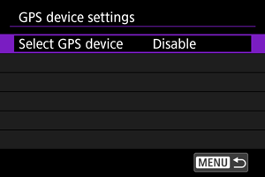
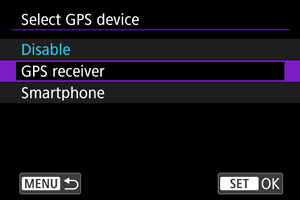
Select [Select GPS device].
-
Select [GPS receiver].
-
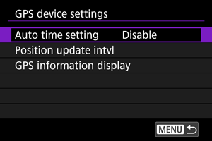
Configure GPS device settings.
- For details on [Set up], refer to the GP-E2 Instruction Manual.
-
Take the picture.
Caution
Precautions when using GP-E2
- Before use, check the countries and regions where use of GPS is allowed, and follow local regulations.
-
Update the GP-E2 firmware to Ver. 2.0.0 or later.
Firmware updating requires an interface cable. For updating instructions, visit the Canon website.
- GP-E2 cannot be connected to the camera with a cable.
- The camera does not record the shooting direction.
Smartphone
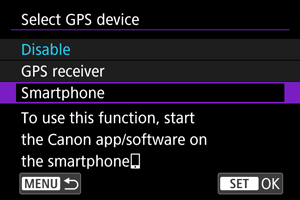
Complete these settings after installing the Camera Connect smartphone app ().
-
On the smartphone, activate location services.
-
Establish a Bluetooth connection.
- Start Camera Connect and pair the camera and smartphone via Bluetooth.
-
Select [Select GPS device].
-
Select [Smartphone].
-
Take the picture.
- Images are geotagged with the information from the smartphone.
GPS Connection Display
You can check the status of smartphone location information acquisition in the GPS connection icon on the screens for still photo shooting or movie recording ( and , respectively).
- Gray: Location services are off
- Blinking: Location information cannot be acquired
- On: Location information acquired
For details on how GPS connection status is indicated when GP-E2 is used, refer to the GP-E2 Instruction Manual.
Geotagging images as you shoot
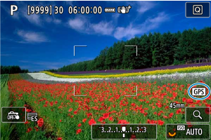
While the screen shows that [![]() ] is on, the images you capture will be geotagged.
] is on, the images you capture will be geotagged.
Geotagging information
You can check geotag information by displaying a shot, pressing the ![]() button to access playback screens with detailed information, and then pressing
button to access playback screens with detailed information, and then pressing ![]() vertically.
vertically.
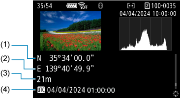
- (1) Latitude
- (2) Longitude
- (3) Elevation
- (4) Coordinated Universal Time (UTC)
Caution
- The smartphone can acquire location information only while it is paired with the camera via Bluetooth.
- Direction information is not acquired.
- Acquired location information may not be accurate, depending on traveling conditions or smartphone status.
- It may take some time to acquire location information from the smartphone after you turn the camera on.
- Location information is no longer acquired after any of the following operations.
- Pairing with a wireless remote control via Bluetooth
- Turning the camera off
- Quitting Camera Connect
- Deactivating location services on the smartphone
- Location information is no longer acquired in any of the following situations.
- The camera power turns off
- The Bluetooth connection is ended
- The smartphone's remaining battery level is low
Note
- Movies are tagged with the geotag information acquired when you start recording.
- Coordinated Universal Time, abbreviated as UTC, is essentially the same as Greenwich Mean Time.